top of page

UTCT

THE FLAGSHIP 100-MILER ROUTE, WITH 7516M ELEVATION GAIN, VENTURES FROM THE NORTHERN MOUNTAIN RANGE OF THE MOTHER CITY TO THE MORE REMOTE SOUTHERN MOUNTAIN, TAKING IN ADDITIONAL TRAILS FROM SILVERMINE TO KALK BAY, SIMON'S TOWN, KOMMETJIE AND NOORDHOEK. 

DISTANCE

164KM

ELEVATION

7516m
D+

CUT OFF

45H

AID STATIONS

14

START/FINISH

GARDENS TECH RUGBY
CLUB

DATE/TIME

21 NOVEMBER 2025

17H00 START

UTCT 100MILE

Since the inaugural Event in 2014, RMB Ultra-trail Cape Town® has grown to become a major international race, with participants coming from 47 counties and boasting one of the world’s best international athlete fields. The Event has also become synonymous with a week-long festival of running where the local community welcomes runners from across the globe to Cape Town. 

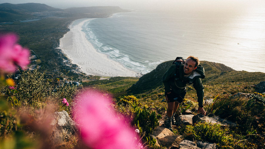
The 100-miler route ventures from the northern mountain range of the Mother City to the more remote southern mountains, taking in additional trails from Silvermine to Kalk Bay, Simon’s Town, Kommetjie and Noordhoek. 

The race starts with a climb out of the city up to Signal Hill and around Lions Head, which provides stunning views of the City and the Atlantic Seaboard. Runners climb midway up Table Mountain's north face and run a contour to Platteklip Gorge, the longest vertical ascent of the race.. After 25km, participants will have already covered an elevation gain of 1700m. 
 
On reaching the top of Table Mountain, runners traverse the famous tabletop ridge, before running along the magnificent 12 Apostles before taking on the technical descent of Llandudno Ravine, eventually arriving at Llandudno Aid Station. The route flattens out along the remote scenic coastal stretches of Sandy Bay and beyond. The second of the four steep climbs is the 600m climb to Suther Peak.
 
Participants venture into the Southern Peninsula after leaving the Hout Bay Aid Station via East Fort and Blackburn Ravine, the third steep climb. Now running in the dark, participants can enjoy the runnable southern trails from Silvermine all the way to Kommetjie Aid Station. Runners are rewarded with a flat 8km beach section to stretch out their legs from Kommetjie to Noordhoek. Participants then make their way along Chapman’s Peak Drive to the start of their fourth major climb up to Chapman’s Peak. From here, it’s homebound via Managanese Mines and Vlakkenberg to Constantia Nek where they head through the vineyards and city greenbelts to reach Alphen Trail Aid Station. There is still some climbing through technical sections of Cecilia and Newlands Forests, followed by a steep drop down to below Rhodes Memorial and the last Aid Station on the outskirts of the University of Cape Town. 

The final 10km requires digging deep with an intense climb to get up to the Blockhouse and lower traverse of Devils Peak. Reaching it marks the home stretch and presents incredible views of the City, the Atlantic Ocean, Table Mountain and Lions Head.
 

PACING

Running an ultra can be a long solo - and at times lonely - day. Sometimes company is the key that can help motivate to keep going. The UTCT 100M Pacing Zone is the section of the course that UTCT 100M runners are allowed a friend to keep them company, a stretch of 105.7km, extended further than ever before.

The Pacing Zone runs from Llandudno Aid Station to Alphen Aid Station. A maximum of three pacers are allowed on to pace the runner, with one pacer at any given time. 


There are seven Pick-Up Pacing Points (including Llandudno) where pacers can drop in and out.

MAP & AID STATIONS

RMB ULTRA-TRAIL CAPE TOWN PRIZE MONEY

FIRST PLACE  R60,000.00

SECOND PLACE R30,000.00

THIRD PLACE  R20,000.00

UTCT_10_circular badge_FC-02.png
web_logo-09.png
  • Facebook - White Circle
  • Twitter - White Circle
  • Instagram - White Circle
  • png-transparent-strava-running-android-android-orange-logo-running-thumbnail_edited
Garmin Logo Without Delta-white-high-res.png
logo_web_wtm.png
Bootlegger Logo_White.png
Jack Black Logo Vector-03.png
Southern Sun Stacked_white.png
Journey's End Logo.png
bottom of page